2023 4th International Conference on Geology, Mapping and Remote Sensing (ICGMRS 2023) was successfully held in Wuhan!
2023 4th International Conference on Geology, Surveying and Remote Sensing (ICGMRS 2023) was successfully held in Wuhan on April 14-16, 2023, which was hosted by China University of Geosciences, co-organized by Beijing University of Posts and Telecommunications, School of Geographical Sciences and Surveying and Mapping Engineering of Suzhou University of Science and Technology, School of Surveying and Mapping Geographic Information of Shandong Jianzhu University, Hubei University of Technology, University of Electronic Science and Technology of China and Greater Noida Institute of Technology of India.
Encompassing the latest achievements in research and applications in the fields of remote sensing monitoring, marine ecological civilization construction, ocean acoustic telemetry, sustainable marine communication, etc., this conference served to share experiences in research and development and discuss the key challenging issues and research frontier hotspots faced by the current field. It consists of invited presentations, a sub-venue on sustainable ocean communication, a sub-venue on the application of high-resolution remote sensing in urban development, a sub-venue on intelligent sensing of multimodal remote sensing data and a sub-venue on intelligent remote sensing imagery, recovery and identification.
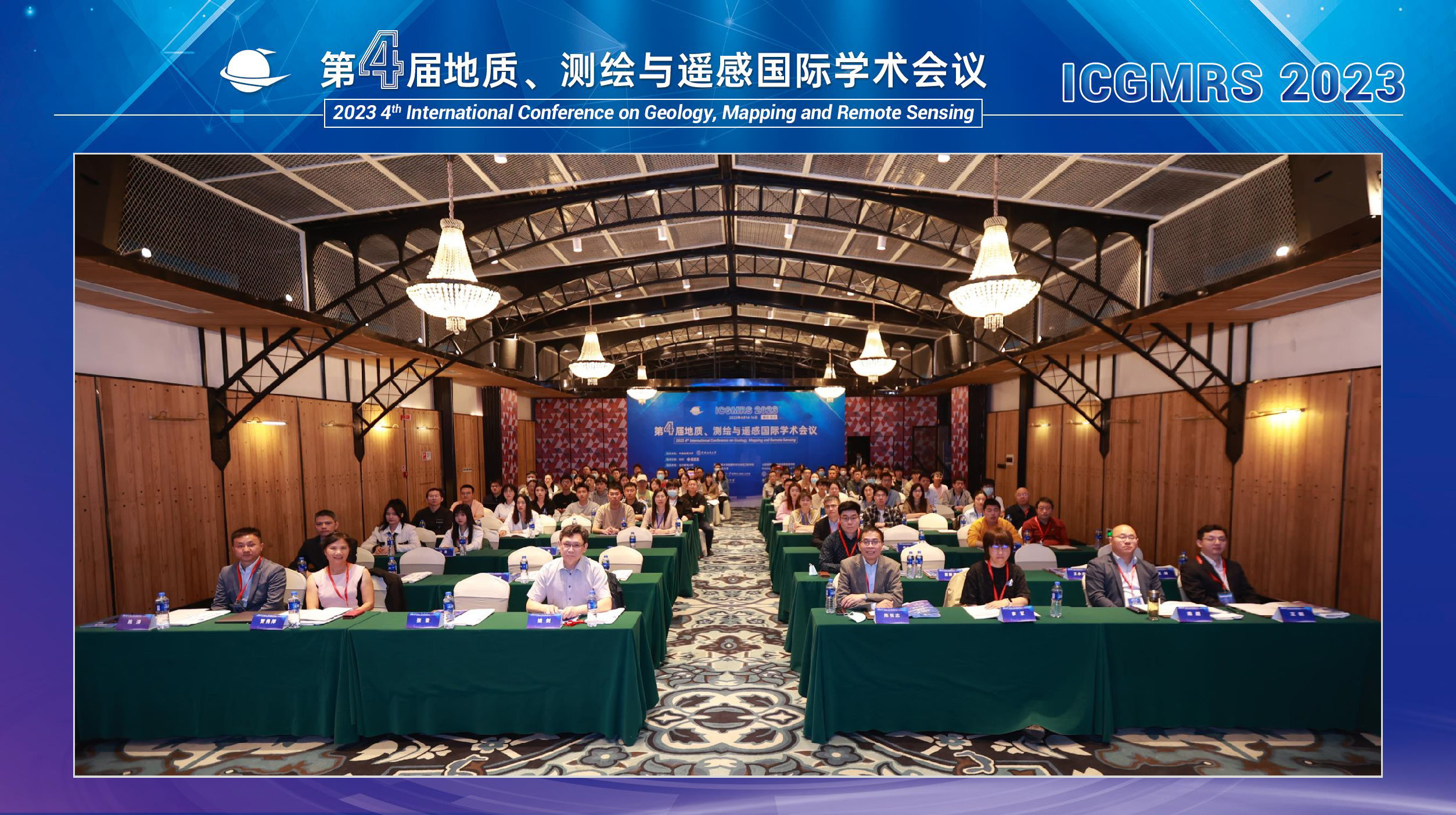
More than 150 domestic and foreign scholars, students and researchers assembled at the conference site from more than 100 universities and research institutes, including Wuhan University, China University of Geosciences, Suzhou University of Science and Technology, Shandong Jianzhu University, University of New South Wales, University of Chinese Academy of Sciences, Tsinghua University, Tongji University, Harbin Engineering University, City University of Macau, Glasgow University, Ministry of Natural Resources, National Marine Environmental Forecasting Center and China Electronics Technology Group Corporation Limited (CETC). Ruizhi Chen, Academician of the Finnish Academy of Sciences and Humanities and professor of Wuhan University, Professor Jian Yao of Wuhan University, Professor Jun Li of IEEE Fellow from China University of Geosciences, Professor Xiuping Jia of IEEE Fellow from the University of New South Wales, Professor Wei He of Wuhan University, Professor Chao Chen of Suzhou University of Science and Technology, Researcher Danfeng Hong of Institute of Aerospace Information Innovation of Chinese Academy of Sciences and Associate Professor Hongming Zhang of Beijing University of Posts and Telecommunications were invited to attend the conference. The main venue of the conference was presided over by Professor Wang Yi and Associate Professor Chen Tao of China University of Geosciences.
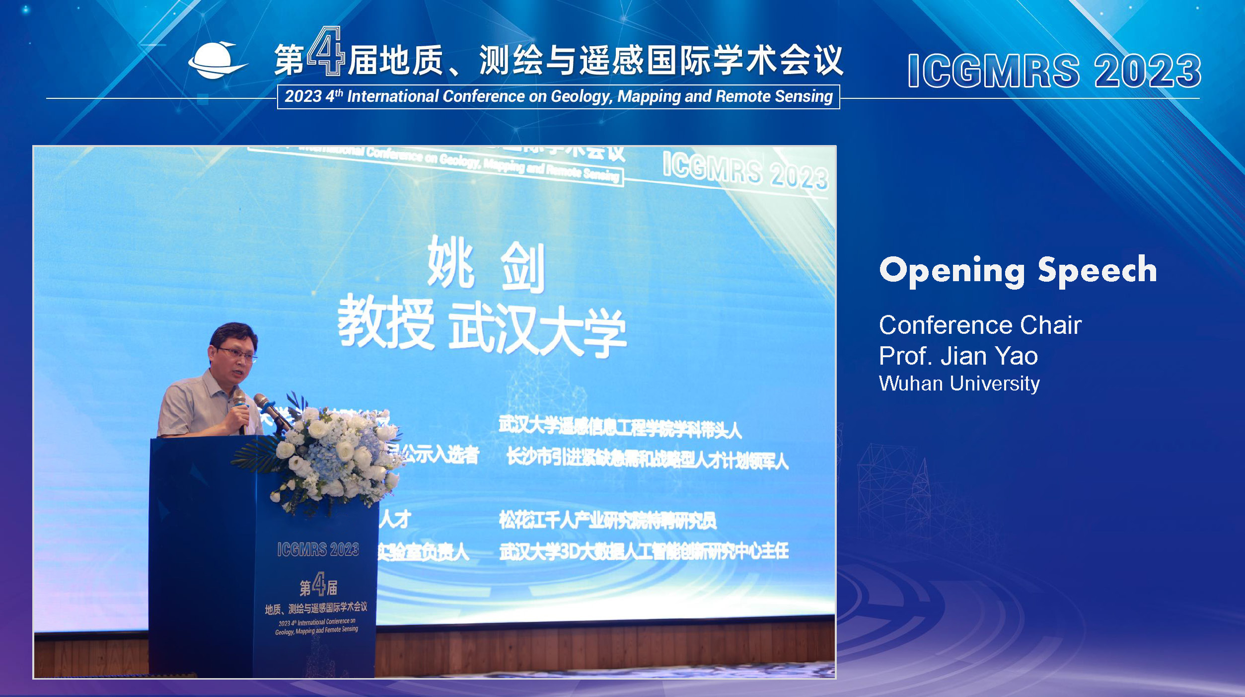
Professor Jian Yao of Wuhan University delivered a speech at the opening ceremony, extending a cordial welcome to all the participating experts, scholars, teachers and students. He pointed out that the current era of artificial intelligence also ushers in new opportunities and challenges to the development of surveying and mapping remote sensing technology, and artificial intelligence is setting off a technological and industrial revolution. He also claimed that surveying and mapping remote sensing is both a beneficiary and a contributor to artificial intelligence technology. It was hoped that this conference would provide a high-end and professional academic exchange opportunity for experts, scholars, engineers, technicians and users engaged in geology, surveying and mapping, remote sensing and marine communication.
Keynote Speeches
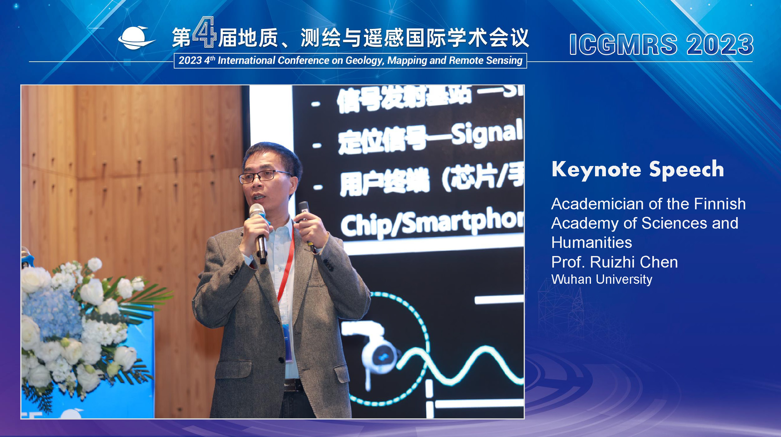
Prof. Ruizhi Chen, Academician of Finnish Academy of Sciences and Letters (Wuhan University)
Title: High accuracy BeiDou ubiquitous positioning and its application
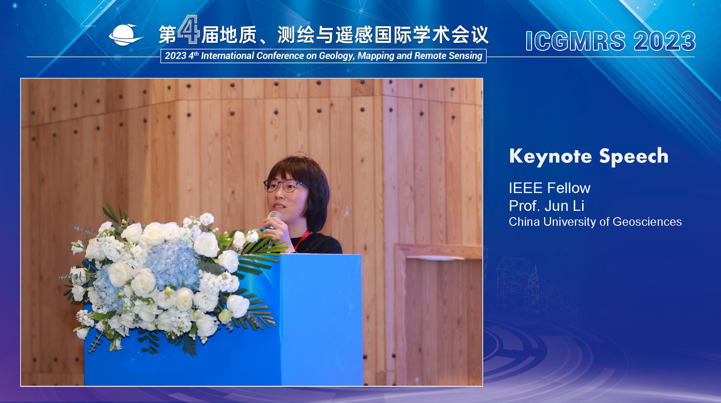
Prof. Jun Li, IEEE Fellow (China University of Geosciences)
Title: Decomposition of mixed pixels in hyperspectral remote sensing images
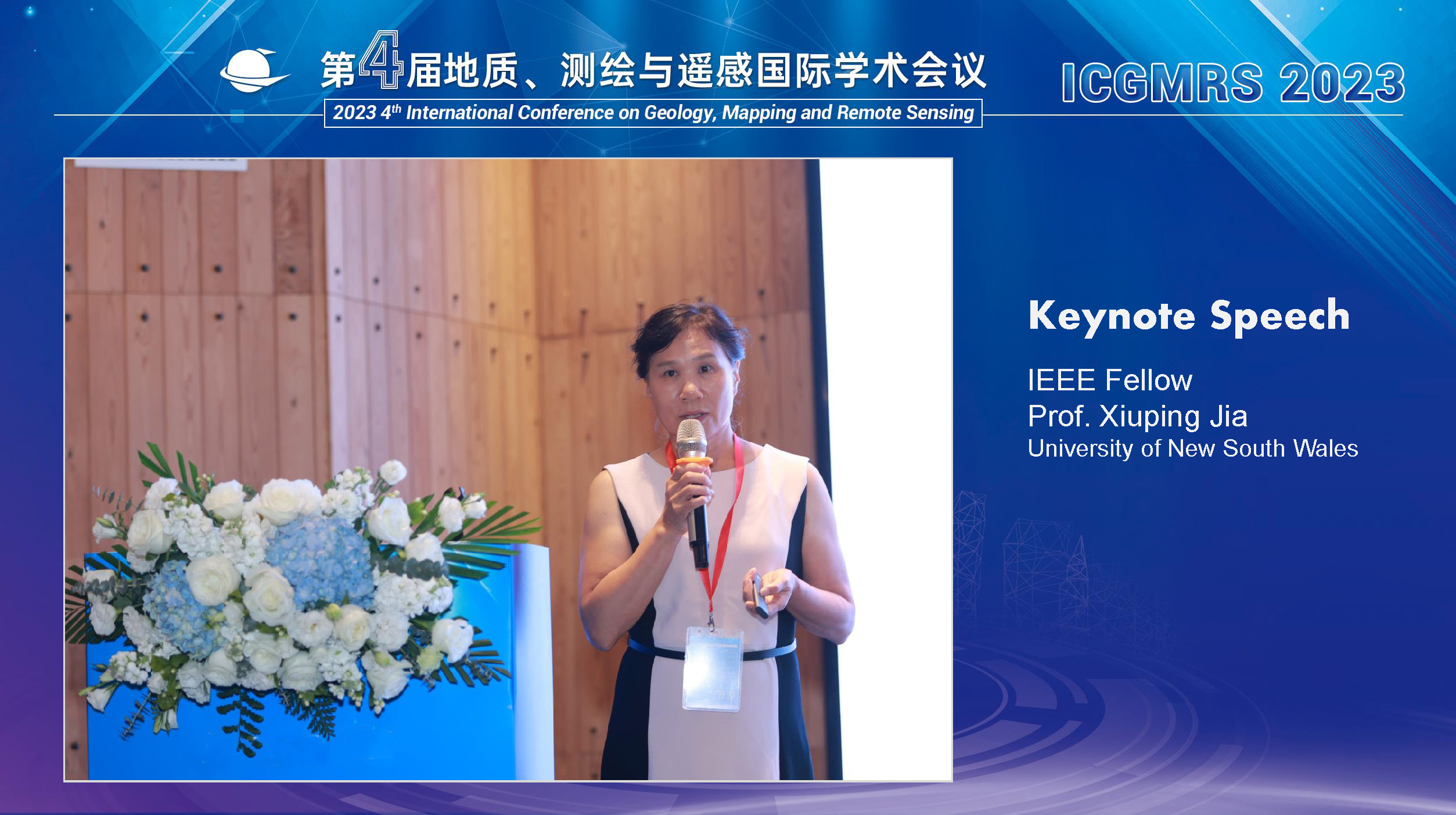
Assoc. Prof. Xiuping Jia, IEEE Fellow (The University of New South Wales Canberra, Australia)
Title: Multiscale hyperspectral information extraction - From Micro to Macro
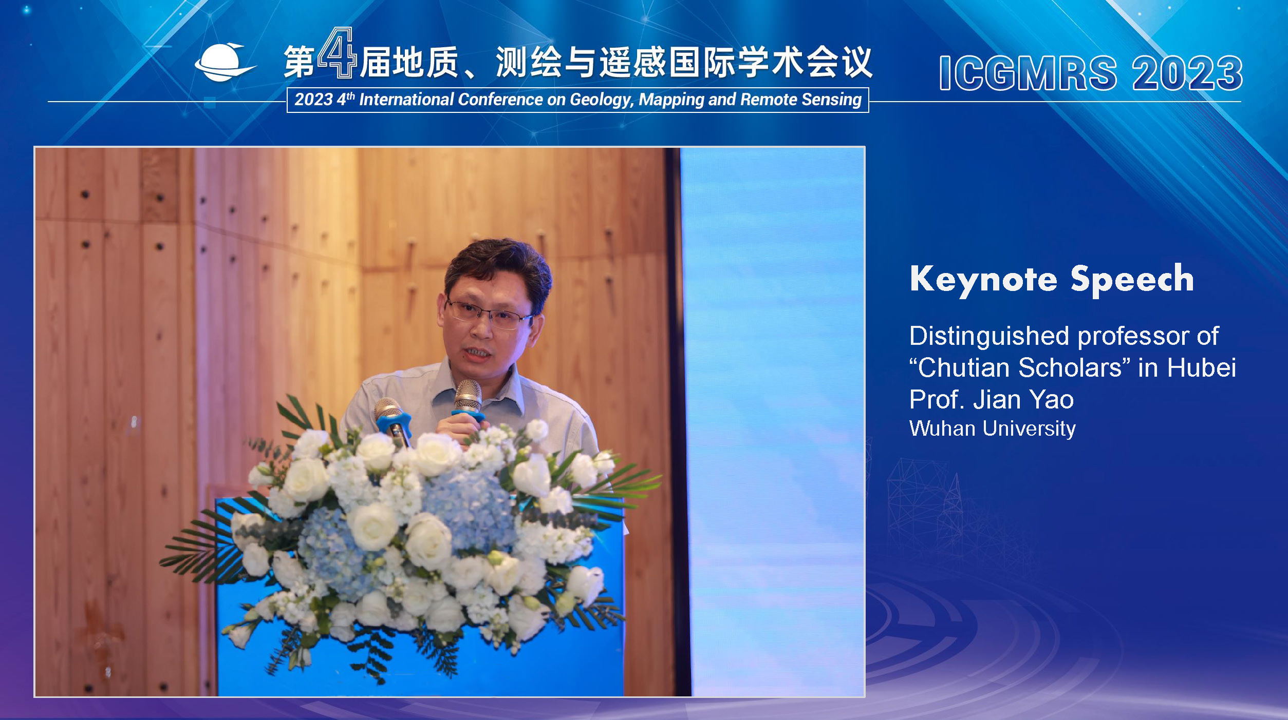
Prof. Jian Yao (Wuhan University)
Title: Challenging issues and key technologies for multi-image fusion
Awarding Ceremony
In appreciation of the great support from Prof. Yi Wang and Associate Prof. Tao Chen from China University of Geosciences as well as Prof. Chao Chen from Suzhou University of Science and Technology, the organizing committee awarded the “Outstanding Contribution Award” to the three experts.
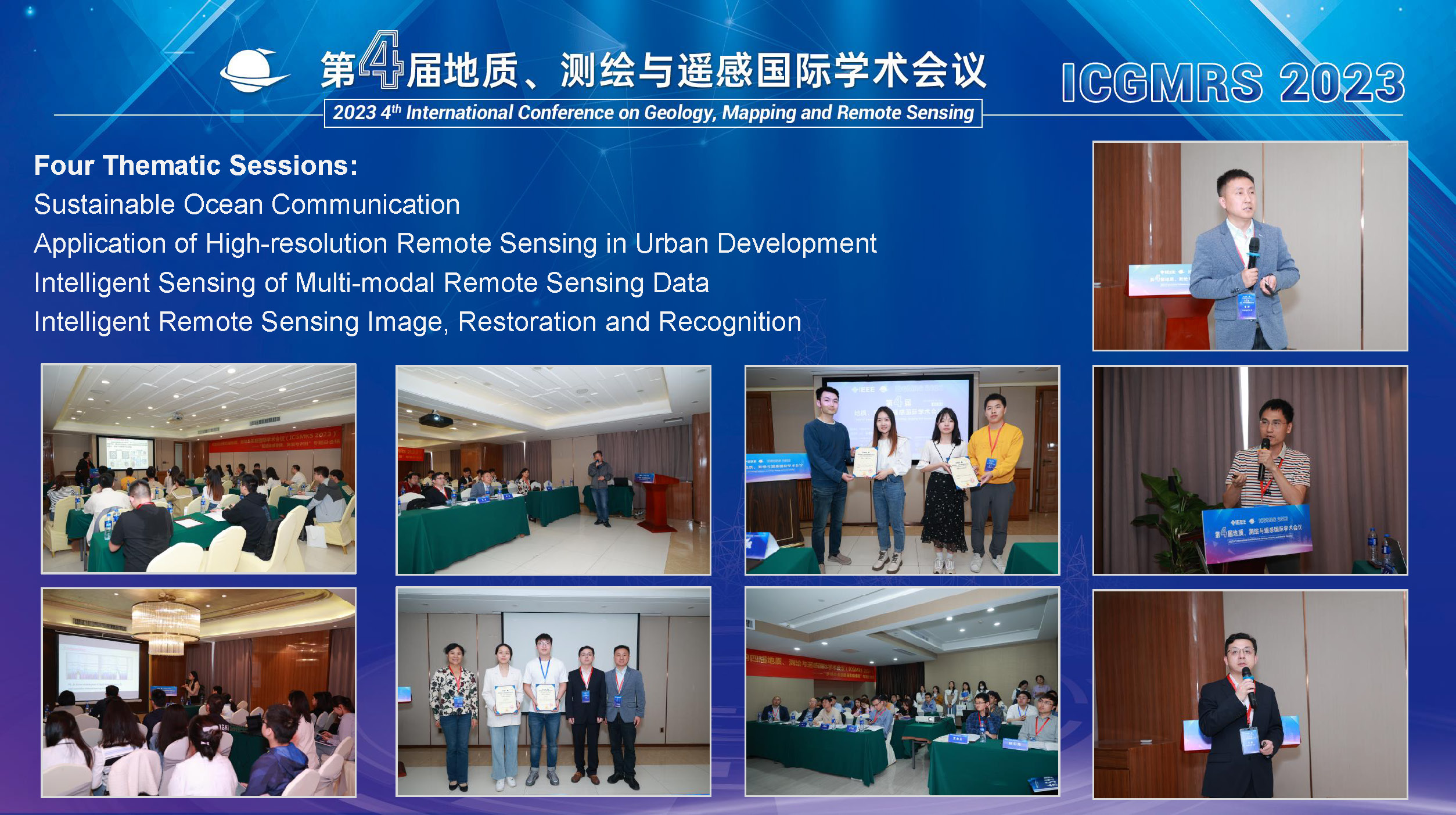
Four thematic sessions, “Sustainable Ocean Communication”, “Application of High-resolution Remote Sensing in Urban Development”, “Intelligent Sensing of Multi-modal Remote Sensing Data” and “Intelligent Remote Sensing Image, Restoration and Recognition”, were held on the afternoon of April 15. 12 invited reports and multiple oral presentations were given, and 8 outstanding report scholars were selected and presented with awards.
Invited Presentations of Thematic Sessions:
Theme I: Sustainable Maritime Communications
Session Convenor: Assoc. Prof. Hongming Zhang, Beijing University of Posts and Telecommunications
●Prof. Liang Xiao, Xiamen University
Title: Reinforcement learning based maritime communications against jamming
●Prof. Ming Jiang, Sun Yat-sen University
Title: Deep Learning Aided Beam Vector Assignment for Massive MIMO Maritime Communication
●Xinjian Ou (Researcher) , No. 722 Research Institute, China State Shipbuilding Corporation Limited
Title: The Challenges and Enlightenments of 5G Technology Applied in Maritime Information Network
Theme ll: High Resolution Remote Sensing in Urban Development
Session Convenor: Assoc. Prof. Xiuping Jia, The University of New South Wales Canberra, Australia
●Prof. Roman Alvarez, National Autonomous University of Mexico (UNAM), Mexico
Title: Geophysical Apprisal of Seismic and Volcanic Risks in Mexico City
●Assoc. Prof. Tao Chen, China University of Geosciences
Title: Remote sensing ecological index with local adaptability and its application
●Prof. Yi Wang, China University of Geosciences
Title: Landslide hazard cataloguing technique based on deep learning
Theme lll: Intelligent Sensing of Multimodal Remote Sensing Data
Session Convenor: Danfeng Hong (Researcher), Aerospace Information Research Institute, Chinese Academy of Sciences
●Prof. Yongzhi Wang, Suzhou University of Science and Technology
Title: Calculation of blast fragmentation of open-pit copper mine using three-dimensional laser point cloud
●Assoc. Prof. Sicong Liu, Tongji University
Title: Multimodal remote sensing image fusion and surface element recognition
●Renlong Hang (Associate Researcher), Nanjing University of Information Science and Technology
Title: Joint classification of hyperspectral and LiDAR data using convolutional networks
●Assoc. Prof. Jie Li, Wuhan University
Title: Time-space-spectral fusion of multi-source heterogeneous remote sensing images based on deep learning
Theme lV: Intelligent Remote Sensing Imaging, Restoration, and Recognition
Session Convenor: Prof. Wei He, Wuhan University
●Assoc. Prof. Renwei Dian, Hunan University
Title: High-resolution hyperspectral intelligent fusion imaging method and devices
●Yong Chen (Lecturer), Jiangxi Normal University
Title: Exploring Nonlocal Group Sparsity Under Transform Learning for Hyperspectral Image Denoising
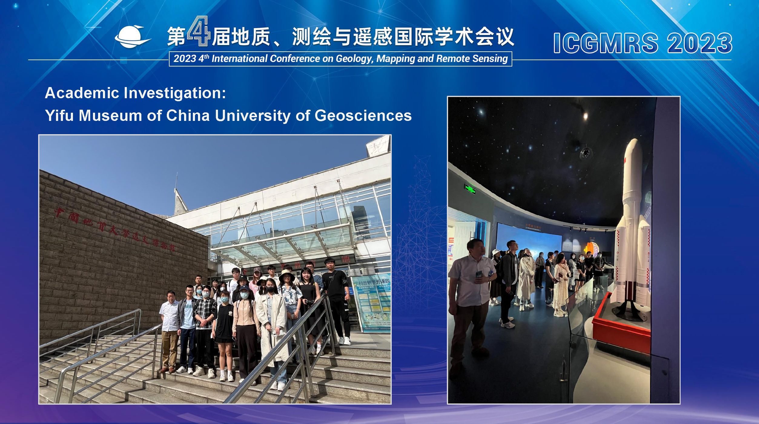
Academic Investigation
On the morning of April 16, scholars went to the Yifu Museum of China University of Geosciences for academic investigation, followed the introduction of lecturers, and witnessed the traces of geological ores and fossil specimens in the collection of China University of Geosciences that confirmed the long history.
Amid the two-day conference, many cutting-edge research results have been shared around remote sensing monitoring, marine ecological civilization construction, marine acoustic telemetry, sustainable marine communication and other topics. Scholars extended a heated discussion, which expanded the academic perspective and fully reflected the influence, academic recognition and extensive academic cooperation of the ICGMRS conference in the fields of geology, surveying and mapping and remote sensing.
2023 4th International Conference on Geology, Surveying and Mapping and Remote Sensing (ICGMRS 2023) has been successfully concluded, and the SCI journal Remote Sensing is still in the process of soliciting contributions, which is expected to be closed in October. At the same time, please look forward to the 2024 5th International Conference on Geology, Surveying and Mapping and Remote Sensing (ICGMRS 2024)!